What a storm system!
The strong low pressure system that has been bowling across the central U.S. has brought freezing rain, sleet, snow, and thunderstorms… and often all of those in the same place! It’s pretty common to get a strong spring storm that produces thunderstorms in the warm air ahead of it, while snow and wintry precipitation follow behind on the cold side. But it is not common for the thunderstorms to occur on top of the cold air, and that’s exactly what has happened with this storm.
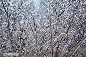
The air temperatures near the ground were well below freezing, in the mid 20s to lower 30s. About 1000-3000 ft off the ground, though, temperatures were warmer than freezing. That warm “nose” of air just off the deck allowed precipitation to become liquid in that layer. If the near-ground sub-freezing layer is shallow, precipitation would fall as freezing rain — the kind that is liquid until it touches the frozen ground, then turns to a glaze of ice. If that sub-freezing layer is a little thicker, the liquid has time to freeze again before it reaches the ground, and it falls as the small ice pellets that we call sleet.
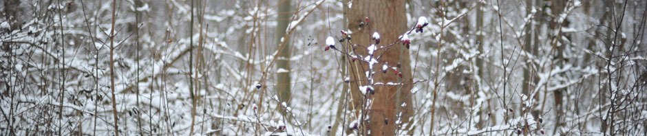
Ice storm in Lawrence, KS, on March 28, 2009.
On Tuesday, April 9, thunderstorms developed in central to northeast Nebraska. The layer near the ground was very cold, but just above it, there was enough instability thanks to that warm nose to let thunderstorms get tall. Ahead of and around the storms, lighter precipitation was mainly falling as either sleet or freezing rain. In the thunderstorms, the precipitation converted mainly to sleet with a few reports of snow. But then the thunderstorms got stronger, and they started to produce large hail! Our weather brains in the weather office kind of exploded a little at the thought of issuing severe thunderstorm warnings for storms that were riding over temperatures below freezing! Our storm spotters were a little uncertain about whether the ice pellets were sleet or small hail… that is, until the hail got bigger and it was clear!
Hubby and I saw a good thunderstorm develop just south of Omaha on Tuesday evening and hopped in the car to go find some hail. We were only a half mile from home when we got the first “thunk” of a stone hitting the car. (And yet, we never had a stone of hail at our house!) The largest stones, on the west side of the storm, were at least golf ball size. As we went further east across the storm, the hail got smaller — roughly the size of dimes to quarters — but it fell in copious amounts that covered the ground and the roads. Luckily, our temperatures were hovering in the upper 30s, so the hail was mixed with rain instead of the frozen varieties.
Talk about the weirding of weather! If this is a harbinger of spring, then this is going to be an interesting storm chase season.
On the bright side, the steady rain for the last several days is giving a beneficial soaking (or wintry coating) to the parts of Nebraska and South Dakota that have been driest. We’re hoping that it’s enough to make a dent in the drought.