As a writing dabbler, I am finally doing the thing that I’ve been saying I was going to do for almost 10 years.
I’m writing a book. The Book. Maybe the first of many books.
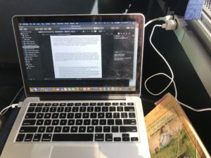
I can carve out an hour here, a half hour there, to write. But not being a full-time writer, it is hard to find those longer blocks of time for deep concentration. My brain covets the scenic quiet and expert guidance of a true writing retreat – held in some beachy or lakeside location, isolated from the world, lightly scheduled, with a mix of writing and coaching. Taking the suggestions of Cathy Mazak and her Facebook group I Should Be Writing, I created my own writing retreat. I can’t replicate the coaching, but I could make up for it with a peaceful space, a block of time, and inspiration from podcasts from the likes of #AmWriting.
For the record, I could not have done this without the encouragement and support of my husband. He knows that I have a book in my heart that’s fighting to see the light of day. He gave me a hall pass from all household duties – in fact, he mandated it during the daytime. No cooking. No laundry. No cleaning up something. He supported putting my butt in the chair and writing. He lifted as much child care load as I was willing to give up, though I did keep my morning ready-time and evening family time free. And he sent me away overnight, because he recognized among Mazak’s suggestions that I needed at least some time away to have the best retreat.
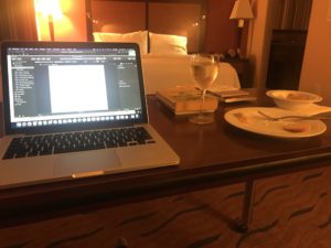
I didn’t want to waste time driving, which aligned perfectly with taking the Amtrak to a destination. Living in Norman, I have access to the Heartland Flyer, which runs daily from Oklahoma City to Fort Worth in the morning and back in the evening. Without much of a destination or sightseeing interest in Fort Worth (great city, but have been there), it was a perfect spot for isolation. I rented a hotel room at the Homewood Suites, precisely because both breakfast and dinner are on site – along with a glass of wine to reward myself if all went well.
Pre-Retreat Preparation: For months, I have been outlining The Book. I had a pretty good sense of what content I wanted to include, at least to begin. The night before the retreat, I opened the outline and gave it a solid look and read, preparing my brain to engage with it.
Retreat Day 1 (Monday): I had some errands to run and chores to do, because we had taken a long weekend trip and I needed to do at least some recovery. Those went faster than I expected, and I had most of the day to write. I brain-dumped some content into two chapters, on topics I had researched and presented the past. 2144 words, which was about double of my goal for the day.
Retreat Day 2 (Tuesday): Some of the content of my book will be drawn from blogs and articles I had already written. I pulled these together from their various sources, then edited them to remove blog-specific references, add content, expand, and blend them into the flow of the chapters. Then I added new content to several chapters. 4548 words, about half of which were new and half pulled from previous writings. Damn proud of that word count.
Retreat Day 3 (Wednesday): Because I had such a jump start on Day 2, I found it a little hard to get started on Day 3. I dabbled in some research in the morning to get the juices flowing, and the words flowed much better from midday through the afternoon. 2802 words.
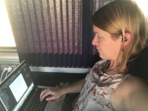
Retreat Day 4 (Thursday): Took the Amtrak down to Fort Worth. Without internet on the train, I was less distracted and more able to focus. I brought the materials to support a deep-dive focus on one particular chapter, and I knew that the word count would be slower as a result. On the way down, I dove into books to work through deepening the content of that one chapter. Once I got to Fort Worth, I sought a cafe-style restaurant in downtown (walking distance of the train station) where I could get a light bite and sit comfortably for a couple of hours. As I walked deeper into downtown, the crowd thickened, and roads were blocked by a heavy police presence. It turns out I had walked right into the path of the presidential motorcade. I took a seat outdoors (lovely weather) at the Flying Saucer Draught Emporium, which was not exactly what I had in mind. I tried to write – and did, a little – but it was more distracting than I expected. I was essentially killing time until I could check into the hotel. The 2-mile walk to the Homewood Suites took almost 40 minutes. Once I checked in, I pulled the chair and table into a comfortable arrangement and got serious, stopping only to fetch dinner from the lobby and also bring a glass of wine to the refrigerator for later. The work remained research-intensive, though I was able to concentrate mightily and work late. 2592 words.
Retreat Day 5 (Friday): By now, with over 10,000 words, my goalposts had moved to a bigger stretch goal – 16,000 words, or roughly a quarter of a target non-fiction book length. After a quick breakfast down in the lobby, I was back in my comfortable suite. I worked through some sections that will be parallel in each chapter, setting up some framing text and filling in part of that content. I nudged back into the in-depth chapter to round out as much of its content as I could. I stayed in my room through 1:00 PM, the late check-out time that they offered me, and then moved myself to the lobby to continue working in a safe, internet-friendly environment until it was time to Uber back to the train station. I called for the Uber quite a bit early, hoping I’d have a space to write while at the station. That didn’t really work out for me, though I did get several pictures and videos of trains for my 4-year-old rail fan. I boarded the Amtrak as soon as it was allowed and settled in again for dedicated, distraction-free writing. I had reserved the introduction section for the return trip home, and I focused intently on it throughout the journey. I raced to complete what I could get written as the train raced through its stops, reaching my goal about 10 minutes before my home station. 3954 words.
If you’re doing the math, the total word count for the week was 16,040. By the end of the week, I felt like a wrung-out washcloth. I had given everything I had available for the book. It was time to set the cloth back down to marinate again, to let the juices return so that they can flow later.
I can write over a thousand words in an hour, if I have a topic at hand and something to say about it. I just did, with this post. Well-researched content takes longer, and the deeper I dive into this book, the slower the words will come as I dig deeper into research and into less familiar corners of the subject. Bit by bit, I will build this book. The one-week retreat provided not just a foundation, but a rough-in of the floor plan and some interior structure. Board by board, tile by tile, wire by wire, this book is under construction. Stay tuned!